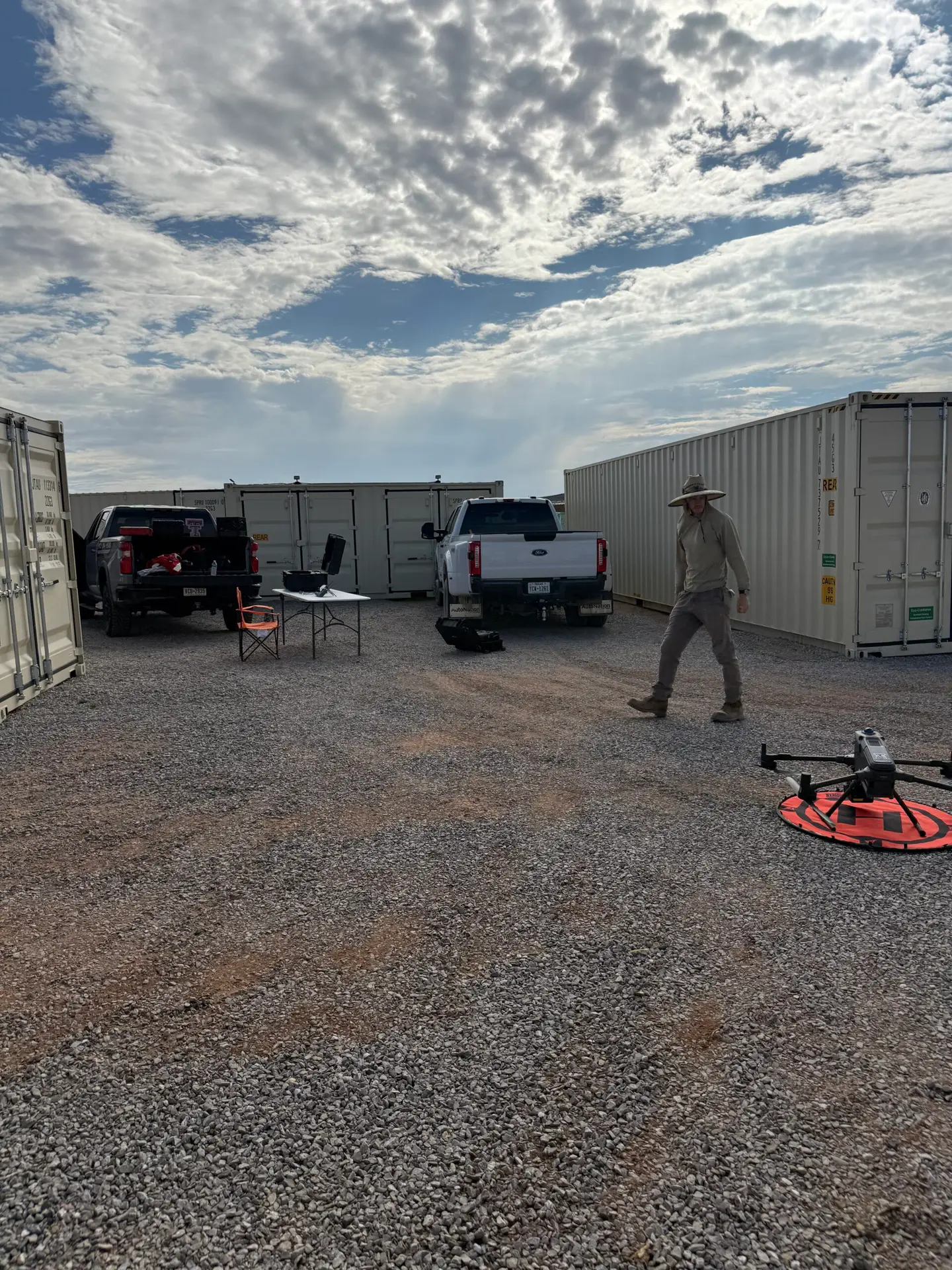
Drone LiDAR for Solar Development: A Hands-On Matrice 400 + Zenmuse L3 Demo in West Texas
A solar developer in far West Texas, east of El Paso, came to us with a specific question: should we bring drone LiDAR in-house? They were weighing the purchase of a DJI Matrice 400 with the Zenmuse L3 LiDAR payload and a DJI Terra processing workstation. Before spending the money, they wanted to watch the complete workflow run on their own land, from base setup to finished terrain model, and judge the data for themselves.
So we drove out and ran it side by side with their site lead. This post walks through what we did, what we delivered, and what any solar or land development team should know before building this capability in-house.
Why solar developers are turning to drone LiDAR
Utility and commercial solar lives and dies on grade. Tracker rows tolerate only so much slope, every foot of cut and fill costs money, and desert washes decide where water goes during the one storm a year that matters. Traditional ground surveys of large tracts are slow and expensive, and they leave gaps between shots.
The client's use cases were the ones we hear from most developers:
- Evaluating existing grade and slope before installation
- Finding where land prep and grading are actually required
- Cut/fill and earthwork planning
- Mapping drainage, washes, and SWPPP stormwater features
- Laying out access roads and solar blocks
- Scouting large tracts before purchase or lease
Every one of those runs on a dense, accurate bare-earth surface. That is exactly what LiDAR produces.
A workflow demo, not a sales pitch
The client specifically chose us because we fly the Matrice 400 and Zenmuse L3 and process in DJI Terra, the same stack they were considering, rather than relying on high-end survey software they would never run themselves. So we set the job up as a hands-on demo. Their site lead stood at our elbow for every step and could take the controller or the mouse at any point:
- RTK and base setup at a remote desert site
- Flight planning in DJI Pilot 2, including line spacing, altitude, and overlap
- The flight itself, with battery swaps and real flight times
- DJI Terra processing, with every setting explained and the reason it was chosen
We also covered how the settings change for rapid reconnaissance of very large parcels, the kind of 1,000 to 10,000 acre scouting work a development team does before a land deal. Survey-level density is not needed for that. Lower density and faster coverage give a team a terrain read in a fraction of the flight and processing time.
The mission
The development site is roughly 100 acres. We planned the mission wide enough to capture the full property plus the surrounding terrain that drains onto it:
- Coverage: about 367 acres across 8.5 miles of flight lines
- Sensor: Zenmuse L3 in LiDAR mapping mode, 350 kHz, linear scan
- RGB imagery: captured alongside the LiDAR (586 photos) to colorize the point cloud and build the orthomosaic
- Airborne time: planned at 30 to 50 minutes depending on wind and battery swaps
A linear scan pattern puts points evenly across the ground. That is what you want when the job is terrain rather than vertical structures.
Positioning at a remote site
Remote West Texas land often means unreliable connectivity, so we plan every desert job as if there will be none. We set up a local base, logged observation data for the full mission, and post-processed the base position through NOAA's OPUS service after the flight. The corrected dataset ties the whole survey to a published datum without depending on a cell signal in the field.
Processing in DJI Terra
A LiDAR dataset of this size is not a quick job. We budgeted 10 to 12 hours of processing and estimated 200 to 300 GB of data for the full mission. We set the project up in Terra on site, walked through the reconstruction and ground classification settings, and started the processing. The finished products followed once it completed.
That processing time is not a footnote. It is one of the most important numbers for a team deciding whether to go in-house. It sets the size of the workstation, how much storage you need, and how quickly results get back to the people making grading decisions.
What we delivered
The finished point cloud came in at roughly 180 million points, colorized from the aerial imagery. The deliverable package included:
- Full LiDAR point cloud (LAS/LAZ)
- Ground-classified point cloud, with vegetation and structures separated from bare earth
- Bare-earth Digital Terrain Model
- Orthomosaic draped over the terrain
- Contours at a 1 ft interval with 5 ft index lines
- Slope and elevation products
- The complete raw L3 mission data, so the client can archive it and reprocess it on their own workstation later
A 3D model the whole team can use
Files are only useful if the people making decisions can open them. We published the full dataset to Stitch3D, a browser-based 3D viewer, and invited the client's team. With nothing to install, anyone on the project can:
- Orbit and zoom the site on a laptop or tablet
- Switch layers, turning off the orthomosaic to read the bare ground on its own
- Measure distance and height between any two points
- Measure area for a block, pad, or laydown yard
- Draw a boundary and calculate volume, which is where the cut/fill conversation happens
Every layer can also be downloaded straight from the project for use in the team's own software.
Being straight about accuracy
We told the client before we left Dallas that this was a workflow demo, not an engineering-grade survey. The Zenmuse L3 is specified at about 3 cm vertical at this altitude, and we report strip-to-strip consistency from the flight. A verified absolute accuracy statement under the ASPRS Positional Accuracy Standards requires 30 independent check points. That means a ground crew, and this project did not need one.
What the client was actually evaluating was grade, slope, drainage, where prep is needed, and whether Terra's output is usable. All of that rides on relative accuracy, and relative accuracy from this system is solid. Distances, slopes, and volumes measured within the dataset are reliable. For anything tied to the site plan, the OPUS-corrected version provides the absolute position.
When a project does need a stamped, engineering-grade deliverable, we plan for it: ground control, independent check points, and a documented accuracy class. See our post on survey-grade drone deliverables for how we do that.
What to know before bringing drone LiDAR in-house
If your team is weighing the same decision, here is what the demo made clear:
- The flying is the easy part. A trained operator can plan and fly a clean LiDAR mission quickly. The discipline is in base setup, RTK fix, and IMU calibration on every flight.
- Processing hardware is a real line item. Large L3 jobs take hours to process and hundreds of gigabytes to store. Size the workstation for your biggest routine job, not your smallest.
- Keep the raw data. Archiving raw mission data lets you reprocess later as software improves or questions change.
- Match the settings to the question. Survey density for grading design, lighter settings for reconnaissance. The wrong choice wastes a day of processing or misses the detail you need.
- Decide how you will share results. A browser viewer gets the data in front of executives, engineers, and field crews without software training.
Frequently asked questions
Can a solar developer run the Matrice 400 and Zenmuse L3 in-house?
Yes, for grade, slope, drainage, and cut/fill planning. The field side is learnable in days. The real investments are a processing workstation that can handle hundreds of gigabytes per job, storage for raw mission data, and the discipline to set up RTK or a base correctly every time. We run demos so teams can see all of that on their own land before they buy.
How accurate is drone LiDAR for solar site grading?
The Zenmuse L3 is specified at about 3 cm vertical at typical mapping altitudes. For grading, slope, and drainage decisions, relative accuracy is what matters, and it is strong. A stated absolute accuracy class under ASPRS standards requires independent check points, which we add when a project needs engineering-grade deliverables.
What if the site has no cell coverage for RTK?
We set up a local base and log observation data, then post-process the base position through NOAA OPUS after the flight. The corrected dataset ties the survey to a published datum without needing a live network connection in the field.
How long does DJI Terra take to process a large LiDAR job?
It depends on acreage, point density, and the workstation. A few hundred acres of L3 data with RGB can take most of a day on a capable machine. That is why we start processing on site, walk through every setting, and deliver the finished products afterward.
Can our team review the data without GIS software?
Yes. We publish the point cloud, bare earth, orthomosaic, and contours to a browser-based 3D viewer. Your team can orbit the site, measure distances and areas, and pull cut/fill volumes from a laptop or tablet with nothing to install.
Work with us
Collin County Drone is a family and veteran-owned commercial drone services company based in Celina, Texas. We fly the DJI Matrice 400 with the Zenmuse L3 for LiDAR mapping across North Texas and travel statewide for the right project. If you are evaluating a solar site, planning earthwork, or deciding whether to bring drone LiDAR in-house, we will run the workflow on your land so you can see the data before you commit. Get in touch or call 972-314-9500.